In 1809, David Thompson opened a trading post for the North West Company of Montréal in their territory. A Roman Catholic mission was founded in the 1840s. The Upper Kalispel were forced onto an Indian reservation in Montana, while the Lower Kalispel remained on their homelands in Washington.
x
x
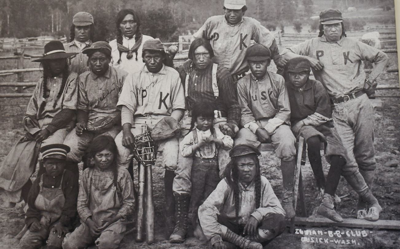
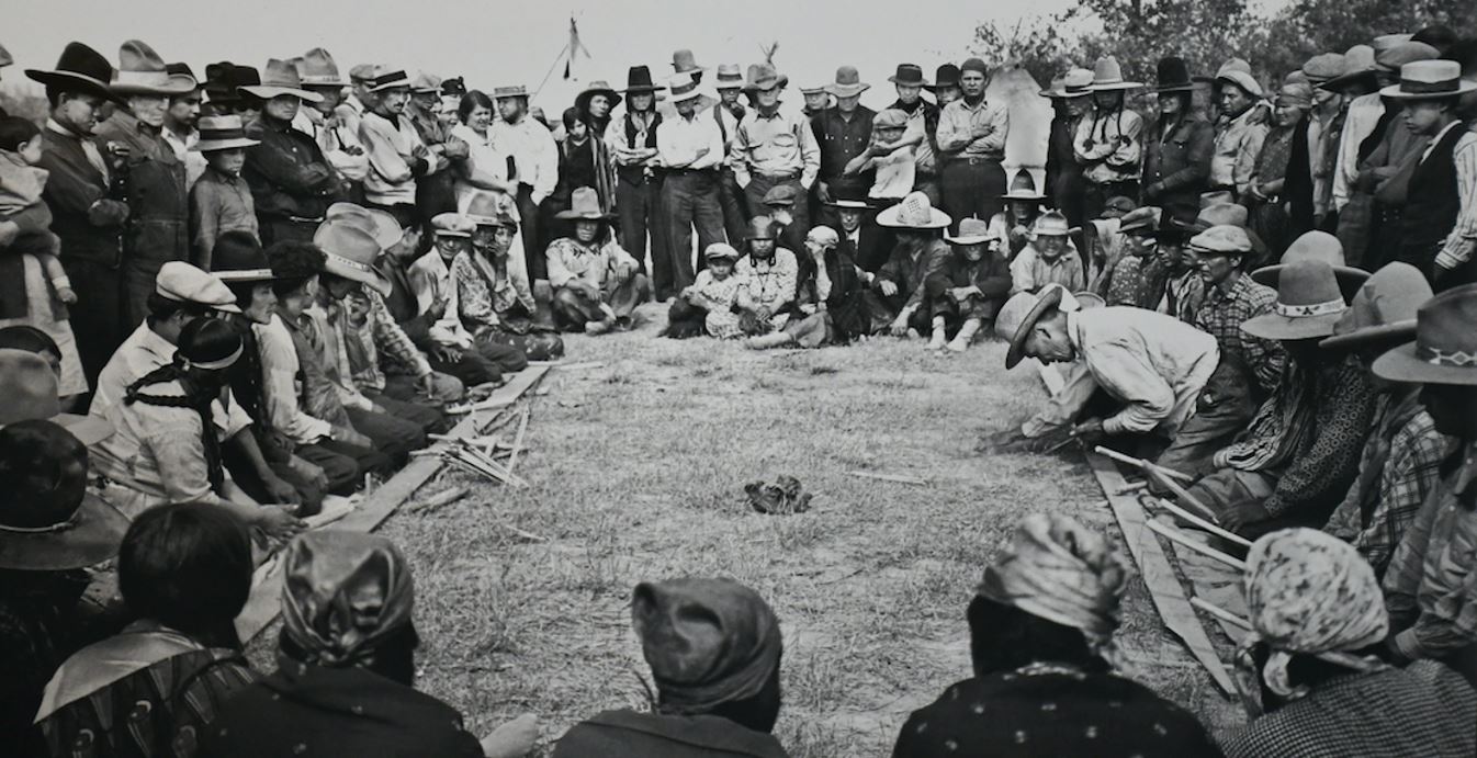
Kalispel Baseball Team
x
x
The tribe refused to sign a treaty proposed by the US government in 1872. In 1875, there were only 395 Lower Kalispel. Non-Natives claimed reservation lands under the Homestead Act, and economic opportunities for tribal members were minimal. In 1965, the average tribal member’s income was $1,400, and there was only one telephone for the entire tribe.
x
x
The tribe owns and operates the Northern Quest Resort and Casino, located in Airway Heights, Washington. The resort features Masselow’s, Epic Sports Bar, Fai’s Noodle House, Qdoba, Rivers Edge Buffet, Fatburger, The Deli, Marketplace, Thomas Hammer Coffee, Ben and Jerry’s Ice Cream, and Movie & Dinner Theatre as well as several bars and nightclubs: Legends of Fire, Fireside Lounge, Liquid, and the Turf, and La Rive Spa. The tribe owns the franchise rights to Fatburger in the Eastern Washington region, having opened a restaurant in Spokane’s 5-Mile district.
x
x
Siomi learning to speak Kalispel
nglixwcut@gmail.com
x
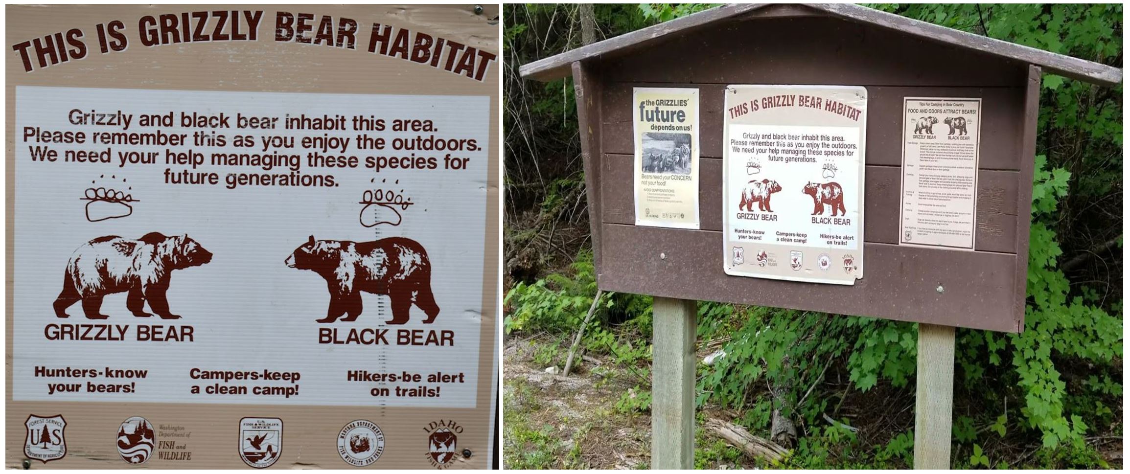
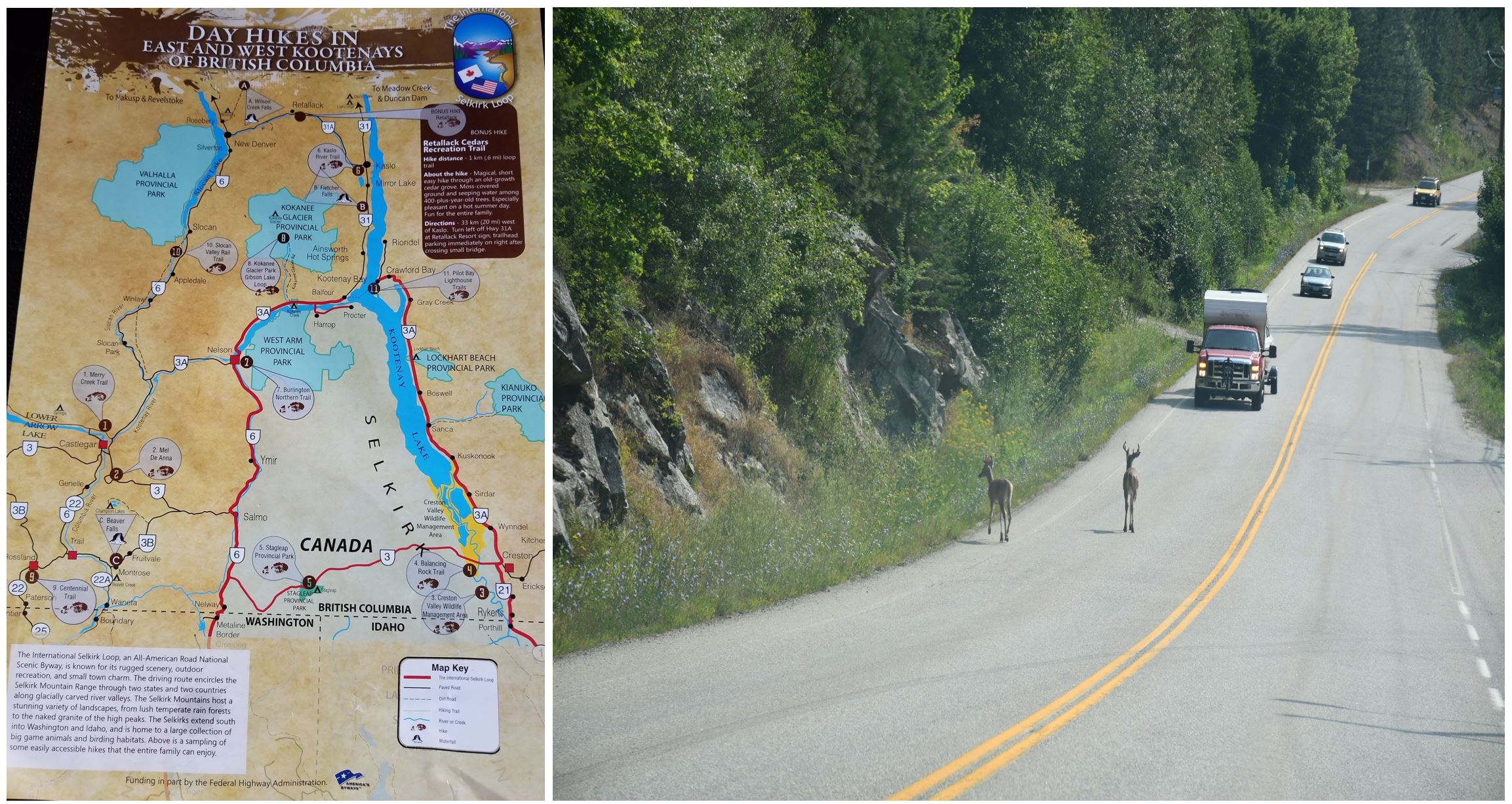
On the way to Canada we stumbled upon interesting events such as warnings about the region’s bears and we got to see a herd of wild turkeys. That impressed us tremendously. Siomi didn’t want to get out of our car, afraid of being attacked by bears.
x
x
Warning about bears…!
x
x
Also, as I said, we stumbled upon a herd of wild turkeys. We expected to see more wild animals, but unfortunately the only thing we saw along our way to Canada were some turkeys and then some deer.
x
x
Wild turkeys…!
x
Siomi was the guide. The one who discovered interesting places. Also, she was the driver throughout the tour, because she loves to drive and I hate driving, although she likes to run a lot and does not keep the proper distance between our car and the car in front of us. Sometimes I have a hard time. I’ve driven enough in my long life, including when I was a truck driver, in 2008, when I toured the United States several times, including much of Canada.
x
x
Siomi explaining our trip so far.
x
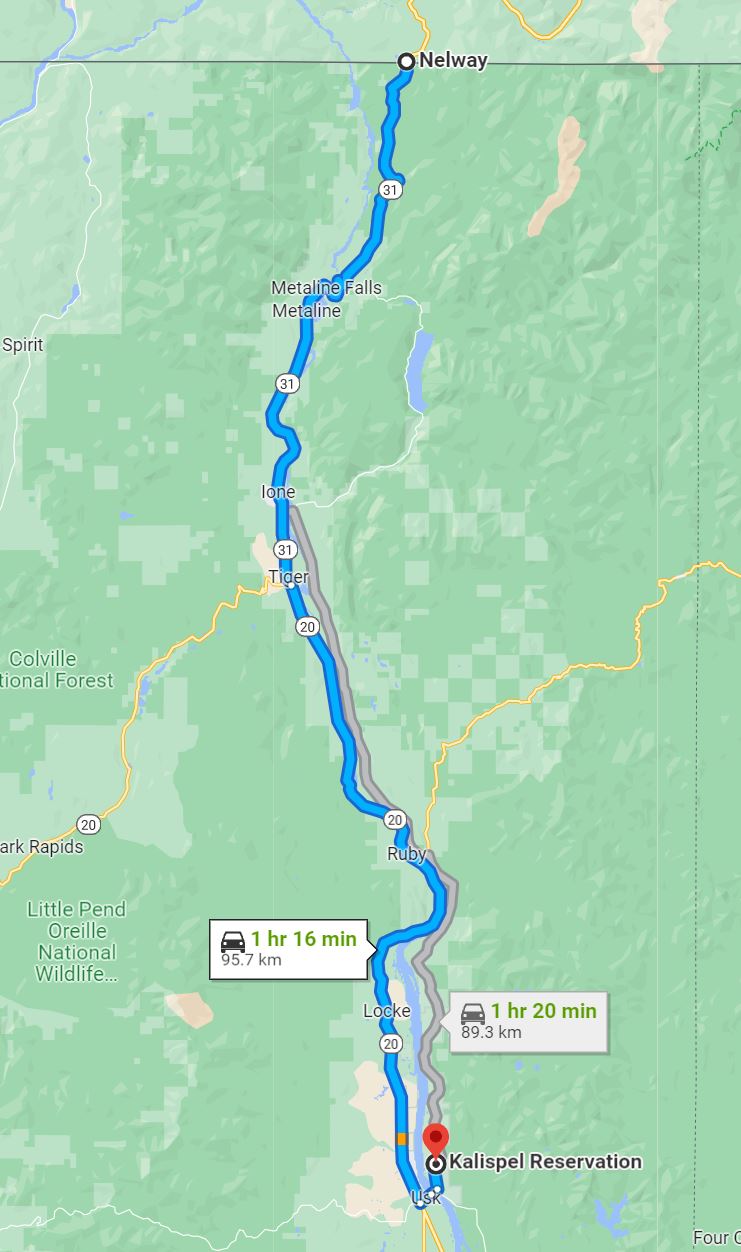
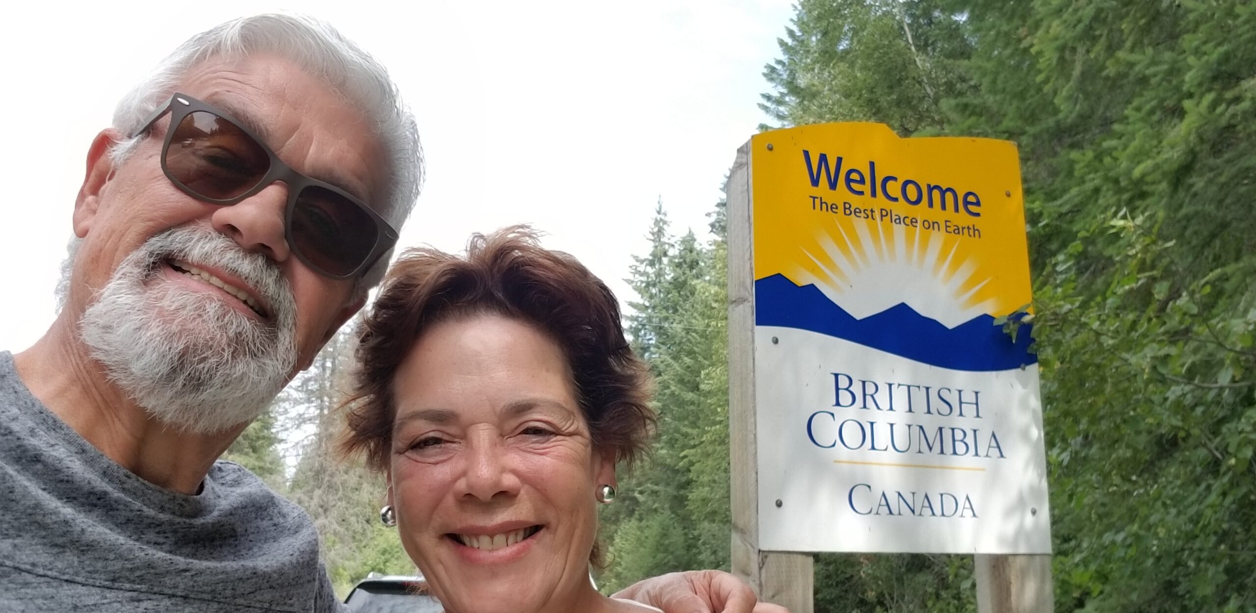
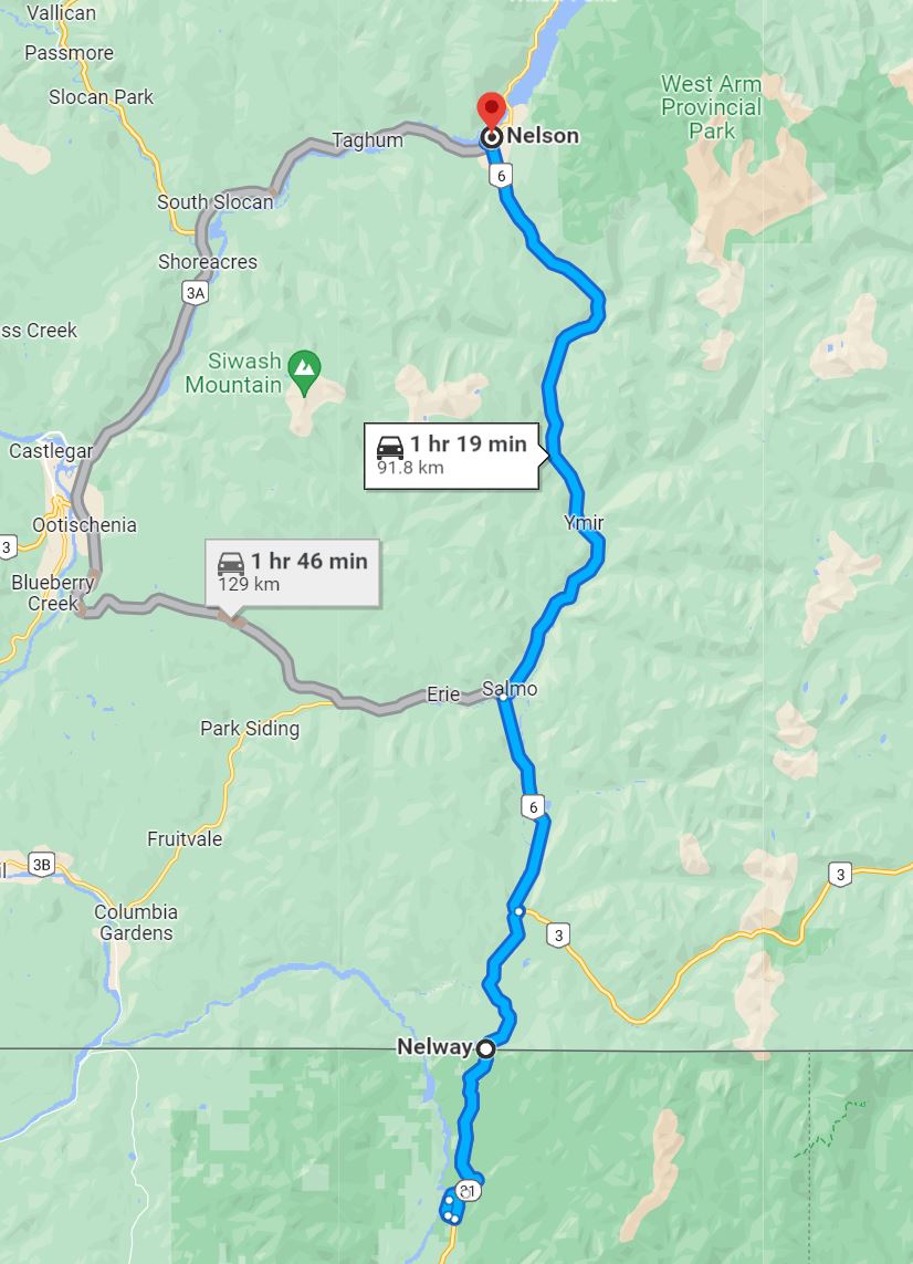
As you could see, our guide, Siomi, was a little misplaced. She placed us in the state of Montana, when we were in Washington State. She wiped Idaho State off the map. But in the end, she found the right path and we headed to the border between Metaline Falls, Washington state and Nelway, British Columbia – Canada. So we will continue on the right track. Of course, always accompanied by good music: our music! The one that takes us back to the past years, which were always better, as so they say.
x
z
The following video is long. It goes from the United States to the town of Nelson in Canada, but accompanied by some pleasant songs. The intention is that we imagine ourselves traveling along those roads adorned with so many beauties, remembering those years when our lives were not so complicated.
x
x
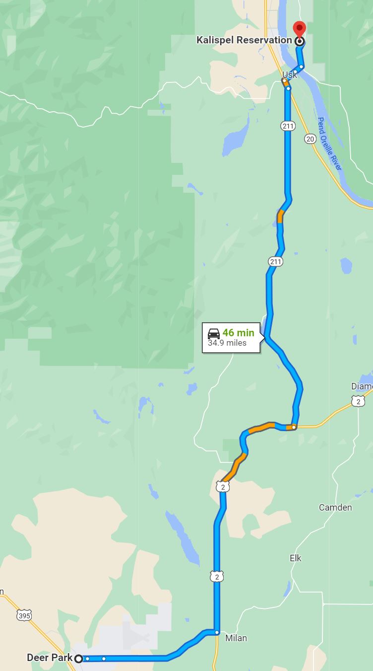
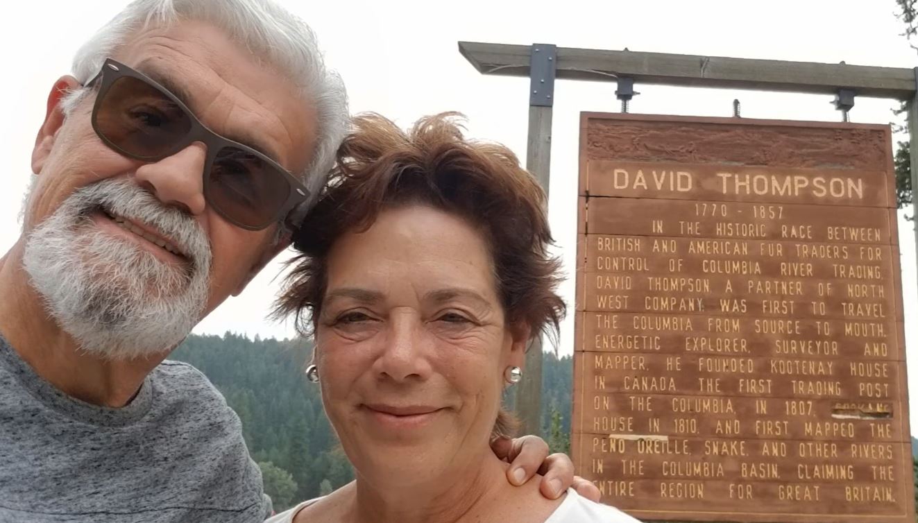
Listening to our favorite music, the Pend Oreille River accompanied us to our left. We visited at the “David Thompson Historical Marker” and skirted Davis Lake and Sacheen Lake. There are 103 miles from Deer Park to Nelway and from there to Nelson another 40 miles.
x
x
Traveling to Nelson, Canada
x
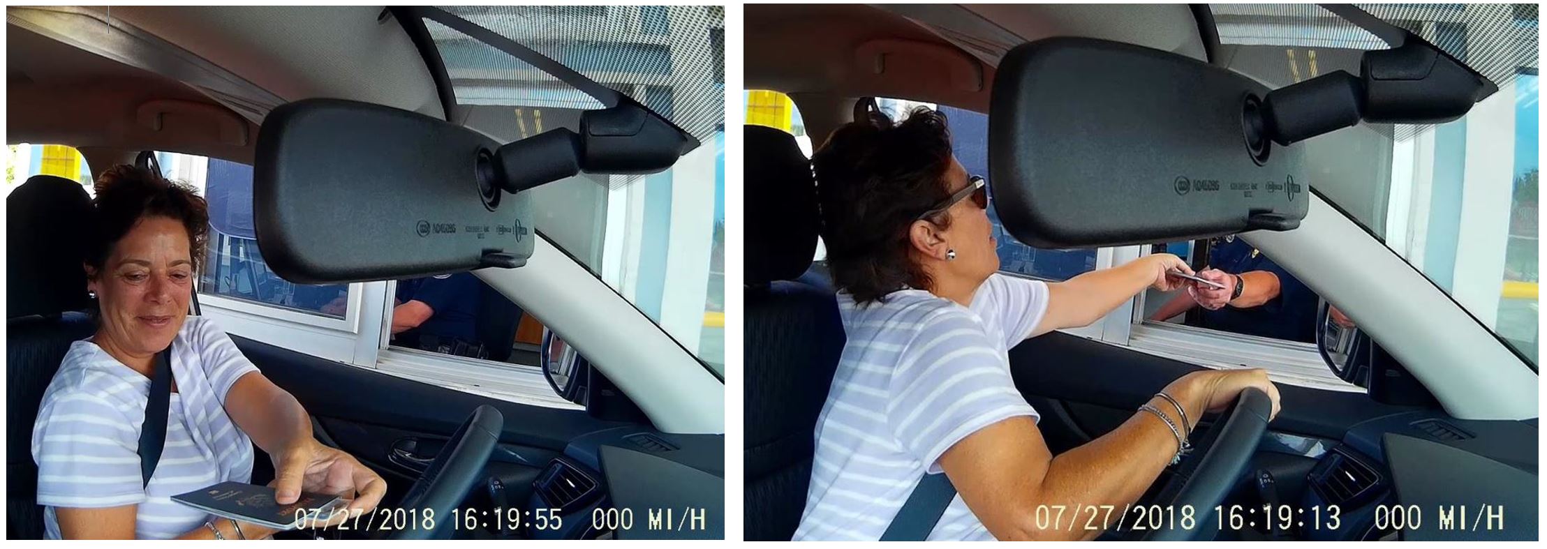
And at last we got to the border with Canada. They treated us to the fullest. Canadians are fabulous. The customs agent told us where we should return to the United States and he was not wrong. Thanks to him we knew spectacular places.
The popular belief is that Nelway is a contraction of “Nelson and Spokane highway,” but could be for Nelson and Fort Sheppard Railway, which passed in the vicinity. Canada has had a customs office in the Nelson area since 1900, but this particular crossing did not exist until the Pend Oreille Highway was completed in 1921. The highway on the BC side officially opened in 1923, but the name Nelway did not appear until 1926.
x
x
The BC part of the highway was subject to criticism for decades because the road was narrow, winding and rough, making travel slow and difficult. To handle increasing traffic, sections were progressively realigned and paved from 1948, and throughout the following decade.
x
x
The US still occupies the original permanent border station at this crossing, built in the mid-1930s; it was recorded on the U.S. National Register of Historic Places in 1997. Canada replaced its depression-era border station in 1951, then replaced it again in 2000. Today the crossing is often used by tourists exploring the International Selkirk Loop,
The western Kootenay region of British Columbia, where the city of Nelson is situated, is part of the traditional territories of the Sinixt (or Lakes) and Ktunaxa (Kutenai) peoples.
x
x
Gold and silver were found in the area in 1867. Following the discovery of silver at nearby Toad Mountain in 1886, the town boomed quickly, leading to incorporation in 1897. Two railways were built to pass through Nelson. Due to its location near transportation corridors, Nelson grew to supply the local mining activity and soon became a transportation and distribution center for the region.
Nelson was named in 1888 after Hugh Nelson, then Lieutenant-Governor of British Columbia. Being an eminently tourist town, it is full of shops of all kinds. We went into almost all of them.
x
x
Shopping around Nelson
x
We were advised not to miss having lunch at “Le Grand Fromage“, Nelson’s cheese shop: san spectacular place! Siomi was in charge of ordering the wine, being she the expert. For my part, the only wine I know of is the “Holy Family Wine” (“Vino Sagrada Familia”, in Spanish), which I served to the priest at masses, when I was an altar boy.
x
x
Cheese Shop
x
x
My favorite cheese, goat cheese and my favorite jelly.
x
x
One of my favorite instruments is the banjo. I learned to play it in Deer Park. The banjo I brought to Venezuela was stolen from me once they broke into our home in Caracas. Since then, I haven’t been able to shake hands with one of these extraordinary instruments. On the streets of Nelson we came across a musician who played a banjo in a masterful way.
x
x
Banjo player – Downtown Nelson
x
Canada, as well as some states in the US, is characterized by being liberal. Marihuana had long been legalized. Of course, we were interested to walk into the store and see how the “cursed weed” is sold freely.
x
x
Marihuana shop
x
We had dinner at the Prestige Inn, whose restaurant is reputed to be good. We had dinner OK enjoying a classical guitarist who accompanied us during our dinner. We ordered our favorite cocktail, Bloody Mary, but it wasn’t very well prepared. One has to look with a magnifying glass for the bar that knows how to prepare it well. Maybe the mistake is in using mixers, such as Mrs & Mr. T and others.
z
x
Dinner time…!
x
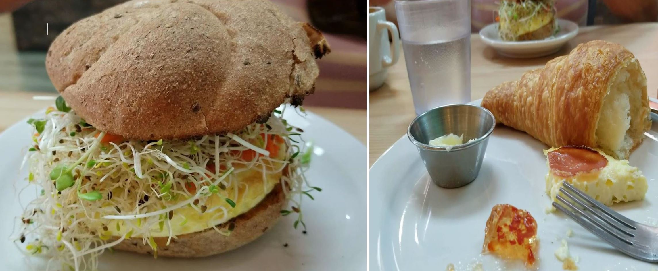
Here I got a kick out of Siomi. She wanted to have an organic breakfast and so we did. Organic coffee, organic sugar and even the innkeepers were organic. Quite tasteless everything and more expensive than in a five-star restaurant in Manhattan. We finished breakfast and the first thing Siomi did once on the street was light a cigarette, destroying everything healthy about the organic breakfast.
x
x
The most expensive breakfast ever…!
x
x
Organic breakfast
x
Walking through the streets of Nelson, Siomi noticed a sign in a store that read “made in Cuba.” It caught our attention and we entered, but we discovered that the place was of a Chinese woman, who among thousands of items, clothes, food, etc., sold Cuban cigars.
x
x
Cuban shop?
Balfour
x
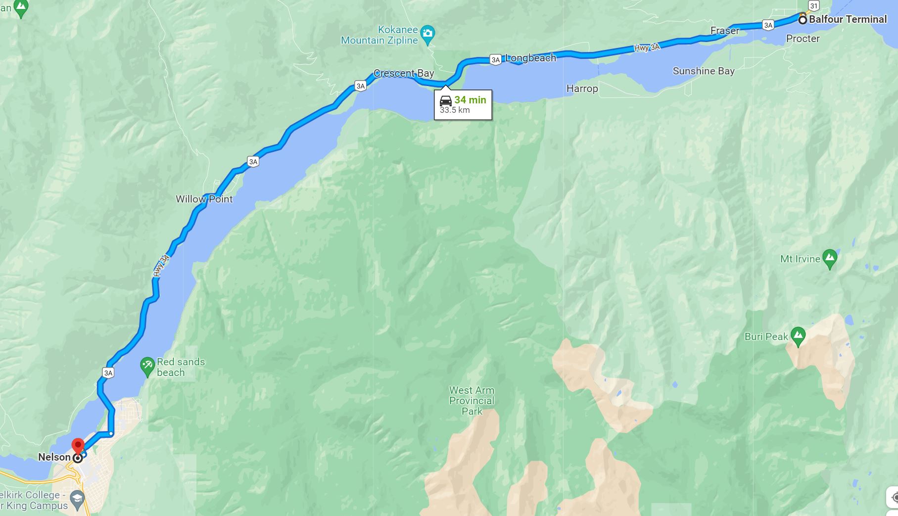
Between Nelson and the ferry terminal in Balfour there is not much to see. Between the 20 miles of travel we pass through the middle to a few small towns: Willo Point, Crescent Bay, Longbeach and Fraser. Balfour is an unincorporated community in the West Kootenay region of southeastern British Columbia. The ferry terminal and former steamboat landing is on the north shore at the entrance to the West Arm of Kootenay Lake. The locality, on BC Highway 3A, is about 33 kilometres (21 mi) northeast of Nelson. The Balfour terminal reminded us a lot of the hippie years of the 60s and 70s.
x
x
Balfour
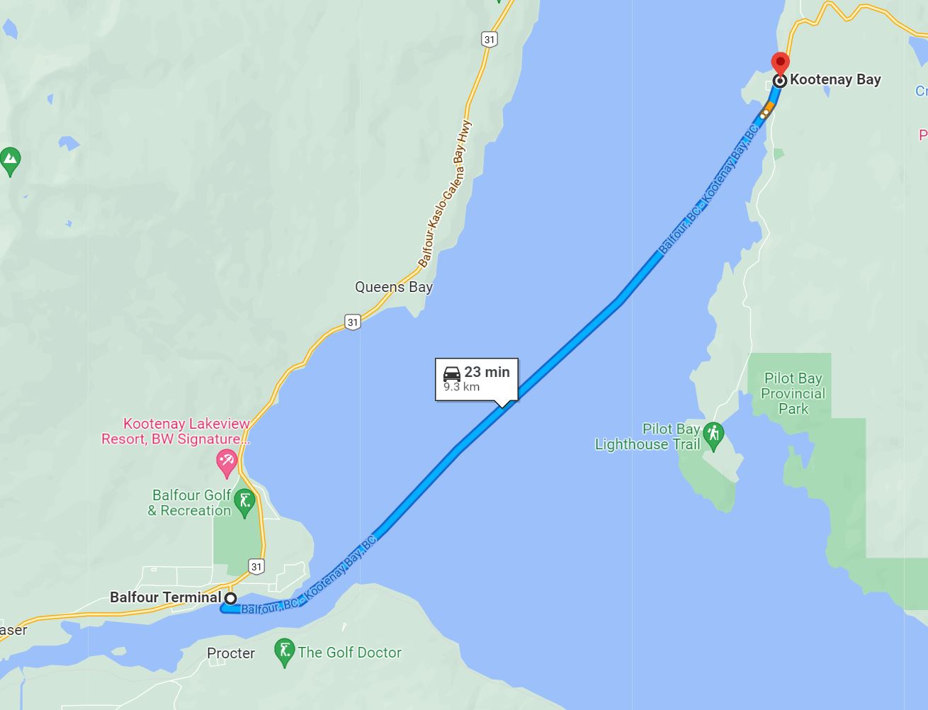
Kootenay Bay
We took the ferry from Balfour to Kootenay Bay, a beautiful navigation of about 40 minutes. There we met a Canadian couple who were riding an impressive motorcycle. We spent the trip chatting with them and getting information about the region. We were recommended The Glass House and to make a short stop in Boswell.
x
x
Kootenay Bay is an unincorporated community on the east shore of Kootenay Lake in the West Kootenay region of southeastern British Columbia. The ferry terminal and former steamboat landing, on BC Highway 3A, is by road about 81 kilometres (50 mi) north of Creston and 4.5 kilometres (2.8 mi) west of Crawford Bay. Formerly called Lynchville, John Lynch built a house on the lakeshore in the early 1900s. When fire destroyed the property, Lynch left, and the bay and shore location became Kootenay Bay. However, the name change did not become official until 1908. An 1897 reference to the Pilot Bay Smelting company’s plant at Kootenay Bay appears a misprint. During this era, the landing was a flag stop for sternwheelers. Some more shopping and lunch. We had a terrific gazpacho and a well-done expresso.
x
x
Kootenay Bay
x
Kootenay Lake is a lake located in British Columbia, Canada and is part of the Kootenay River. The lake has been raised by the Corra Linn Dam and has a dike system at the southern end, which, along with industry in the 1950s-70s, has changed the ecosystem in and around the water. The Kootenay Lake ferry is a year-round toll-free ferry that crosses between Kootenay Bay and Balfour. The lake is a popular summer tourist destination.
x
x
Ferry to Kootenay Bay
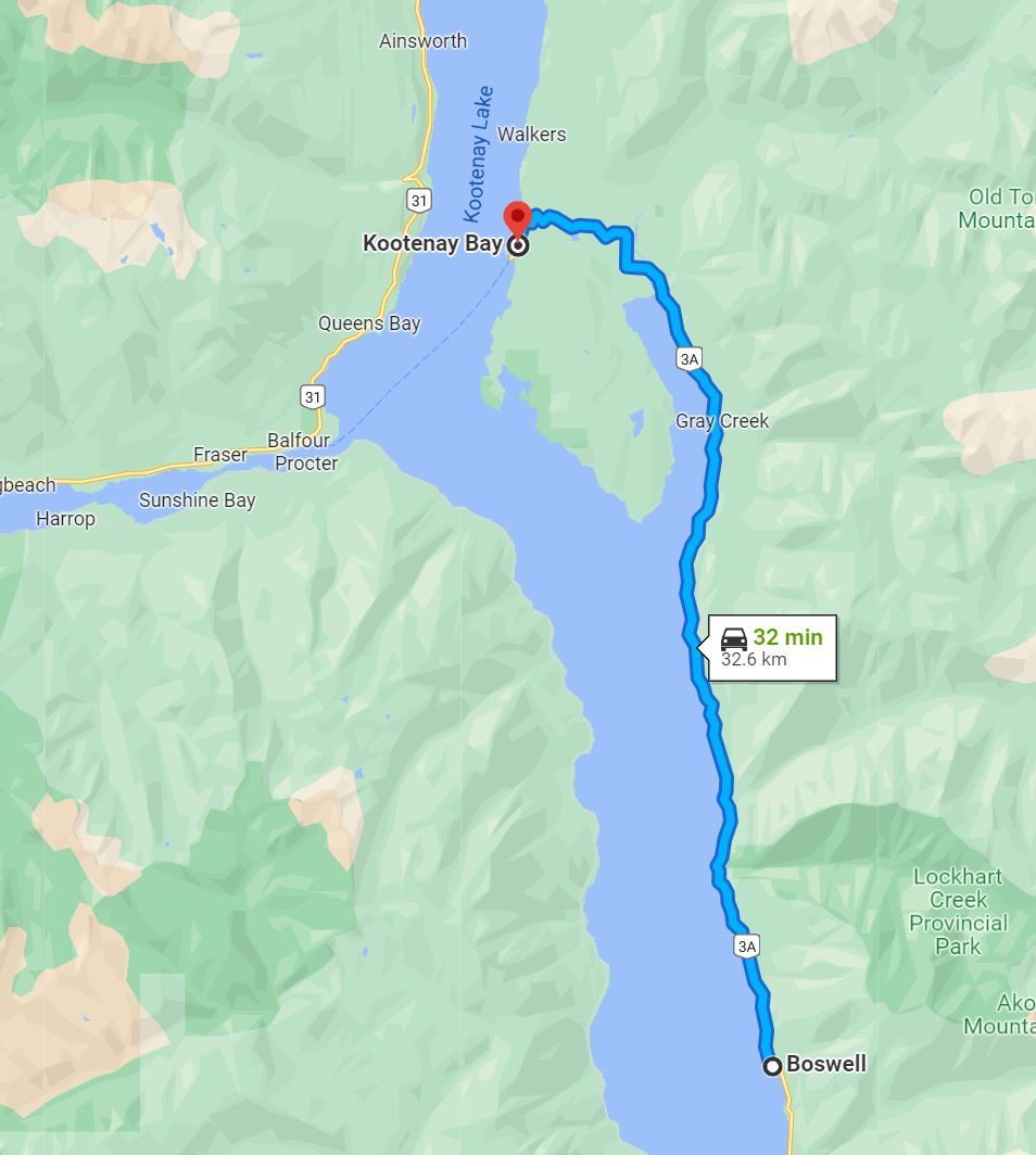
Boswell
Following the recommendations of Canadian motorcyclists, we took the road along Lake Kootenay to a stop called Boswell. Truth be told, I don’t know why we were recommended this stop, but the half-hour walk was worth it.
x
x
Boswell, formerly called McGregor, is a rural locality on the east shore of Kootenay Lake approximately 35 kilometres (22 mi) due east of the city of Nelson, in the West Kootenay region of southern British Columbia. It is named after land surveyor Elias John Boswell.
x
x
Boswell
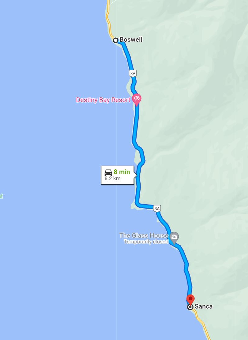
Glass House
The Glass House, built by David H. Brown, is located on the east shore of Kootenay Lake in British Columbia near the rural locality of Boswell, British Columbia. Construction started in 1952 in order to, according to a quote left by Mr. Brown, “indulge a whim of a peculiar nature“. Intended to be the Browns’ home, the unusual construction and fantasy-castle appearance attracted traffic from the adjacent British Columbia Highway 3A (now part of the scenic International Selkirk Loop). The resulting loss of privacy led to the Browns’ establishment of a roadside attraction in the summer months.
x
x
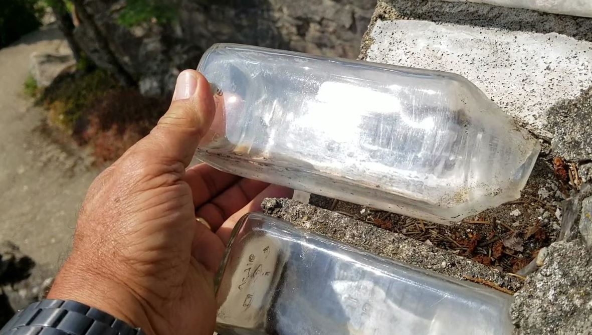
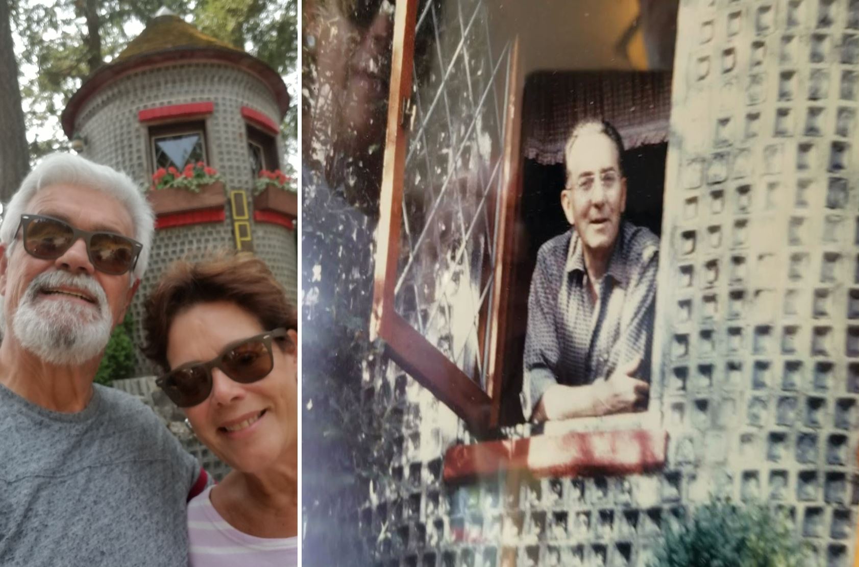
The Glass House sits upon solid rock overlooking Kootenay Lake and is constructed of approximately 500,000 empty embalming fluid bottles, which would have otherwise been discarded as waste. Built with a single layer of bottles laid with the short neck towards the inside, strips of wood were wired between the necks and reinforced with cement. The strips of wood then support the inner walls formed of cedar boards. The main house is built like a three-leaf clover with the main rooms being circular. A short staircase in the center accounts for the different heights created by the rock on which the house sits. The main floor contains the living room with a large fireplace, the master bedroom, and a kitchen overlooking a terrace. A second bedroom resides upstairs, off-limits to visitors, and brings the total square footage to 1200 (approximately 111 square meters). Additional structures include a wishing well with waterwheel, an archway, a garden shed, a bridge, several towers, and many stone stairs and pathways. These additional buildings are also primarily constructed with the same technique as the house.
x
x
Glass House
x
x
Si0mi and I – David H. Brown
x
x
One of the embalming fluid bottles used by Mr. Brown to build his home.
Home!
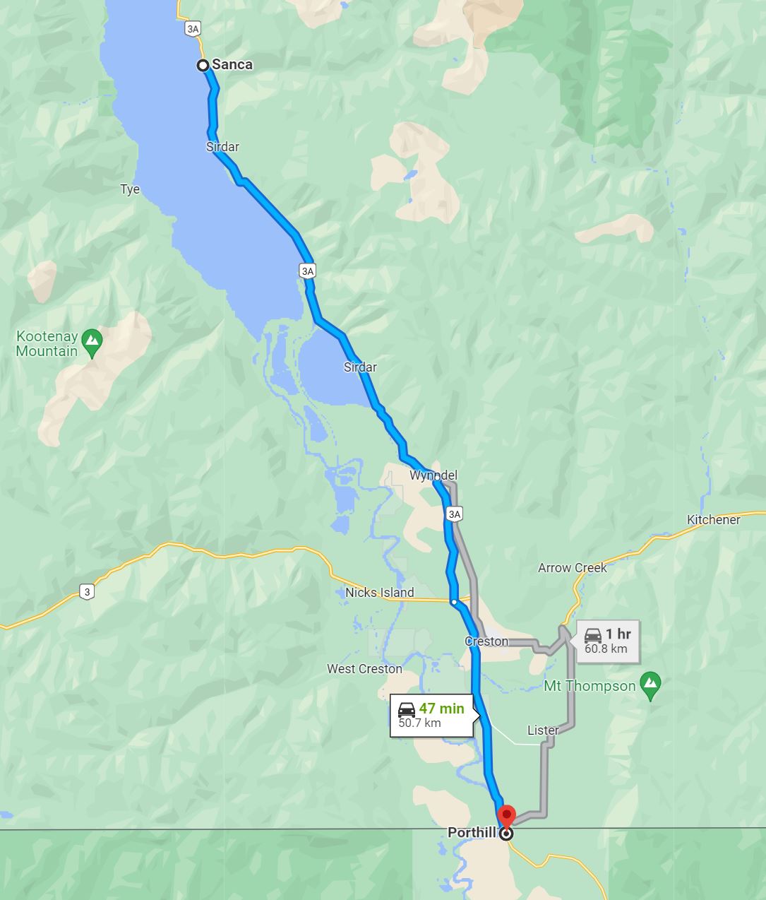
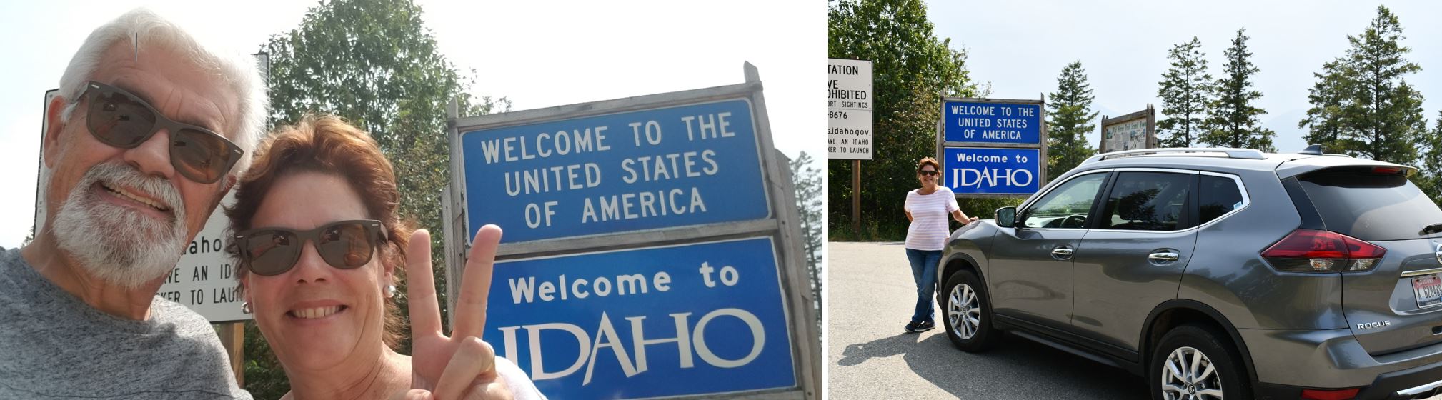
At last we were returning to the United States. We still had a long way to go to get to our resort. Siomi drove the entire way. We entered through the American customs of Porthill, Idaho.
x
x
The Porthill-Rykerts Border Crossing connects the town of Bonners Ferry, Idaho with Creston, British Columbia on the Canada–US border. Idaho State Highway 1 on the American side joins British Columbia Highway 21 on the Canadian side. In 1860, a boundary cairn was erected on the east bank of the Kootenai River. The former US name was Ockonook, meaning “a grassy hillside with rocks.” Around 1871, David McLoughlin and family relocated south from the Kootenay Flats to Ockonook, where he built a log house, which also served as a trading post and a hostel for prospectors traveling downstream. In 1878, prospector George Wallace Hall preempted 320 acres (129 ha) in today’s Lister, British Columbia.
In 1883, John C. Rykert established a Canadian customs station immediately north of the boundary to intercept steamboats and other river traffic sailing from Bonners Ferry to Kootenay Lake. Rykert was a customs officer, immigration inspector, gold commissioner’s agent, and registrar of shipping.
x
By 1890, Mike Driscoll was proprietor of the Palace hotel at what was then known as Rykert’s custom-house. To Mr. & Mrs. Richard Wood, Ockinook residents, were born children in 1891 and 1892, before the family moved to the Creston Valley in 1898.
Major Joseph I. Barnes was the US inspector of customs until the end of Benjamin Harrison‘s presidential term in 1893. That year, Barnes became the inaugural US postmaster at Ockonook. Charles Plummer Hill took over as the US customs officer, a position he held for 10 years.
William Roger Huscroft and family rafted down the north-flowing Kootenai River to Ockonook, crossing the border in September 1891 to settle just on the other side. The family built a log cabin across the river, which the 1894 spring flood reached, requiring towing to higher elevations as the waters rose. Consequently, the family relocated to Lister, part of which is known as Huscroft.
x
x
Prior to Miss Agnes McKay becoming the inaugural government schoolteacher at Ockonook in 1895, David McLoughlin taught the settlers’ children from both sides of the boundary using a room in Mike Driscoll’s rudimentary hotel. The McLoughlin farm residence was 200 yards (183 m) south of the boundary. In the mid-1890s, Clarke Quarrie was proprietor of the Boundary Line hotel.
By 1897, J.I. Barnes also ran a general store. That year, McLoughlin received a land patent for 120 acres (49 ha) on the present site of Porthill. C.P. Hill challenged the title, but prior to a court case, Hill purchased 80 acres (32 ha) from McLoughlin. That year, as postmaster, Hill succeeded in renaming the settlement Porthill, (called Port Hill by the railroad). Hillcrest Mines, now part of the Municipality of Crowsnest Pass, Alberta, is also named after Hill.
From 1897, the place name Bedlington was synonymous with Rykerts. Bedlington was a mining camp in the boundary vicinity. The Bedlington & Nelson (B&N) stop immediately north of the boundary initially assumed this name but had been renamed Rykerts by 1904. Over time, the Bedlington name fell into general disuse.
During the 1890s, provincial Constable Sloan was stationed at Rykerts, and beef drives from Alberta commonly came south into the US and north through Porthill.
x
x
Back home to the USA…!
x
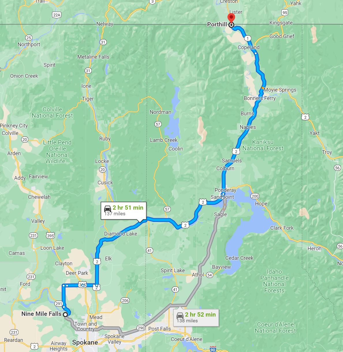
We still had about three hours by road to get to our destination, Nine Miles Falls, in Spokane, Washington.
x
Flying back
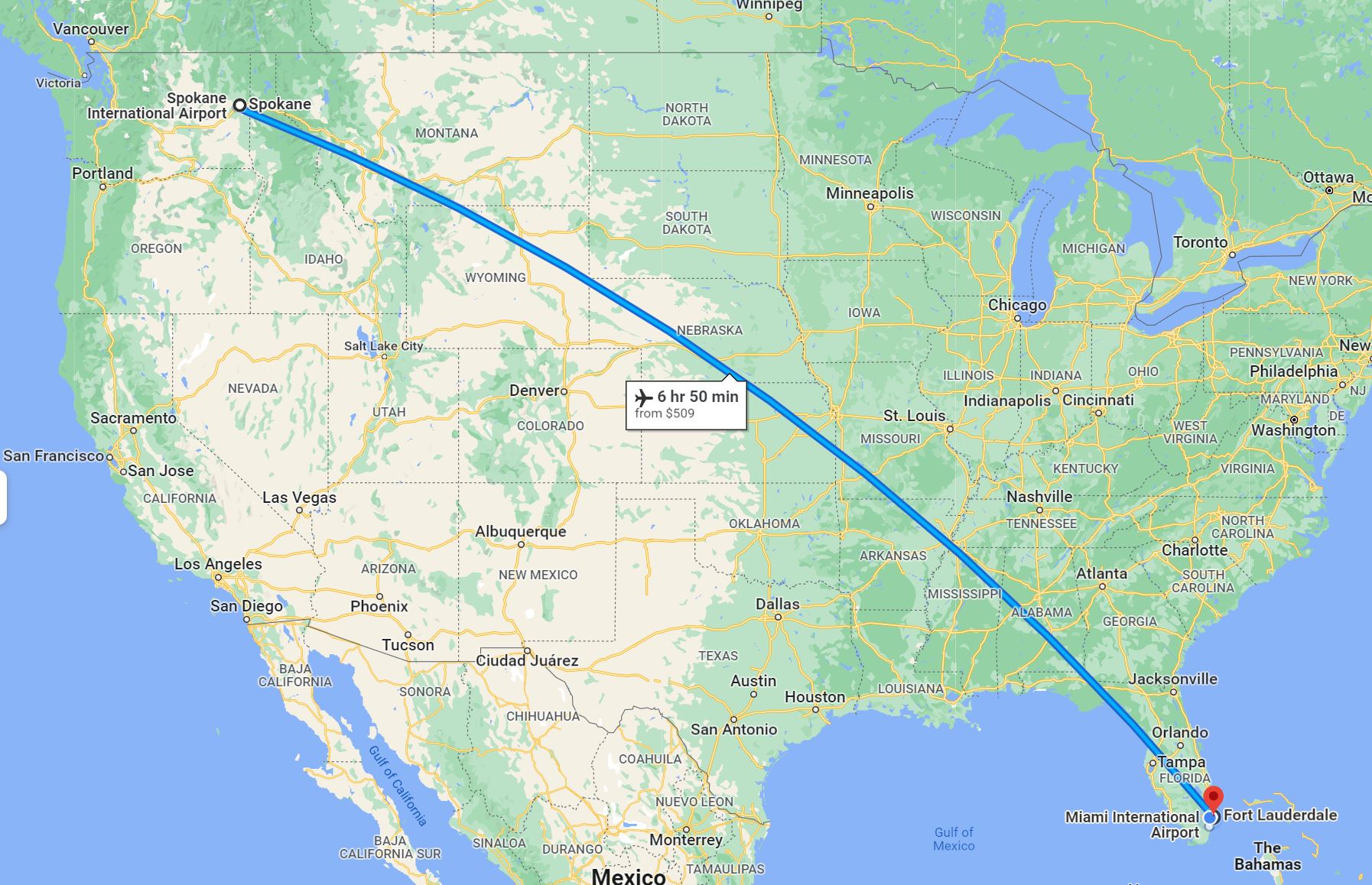
Unfortunately, we were unable to visit Salt Lake City upon our return to Ft. Lauderdale.
x
The Mexican
To close our trip with a flourish, at the Ft. Lauderdale airport we sat next to this Mexican passenger who was waiting to be picked up. It all happened while we were waiting for our bags. I found the conversation of this picturesque character very nice. I didn’t know if he was drunk, high, or in a “normal state.”

 x
x